AIM
4/3/14
2−3−16
Airport Marking Aids and Signs
FIG 2
−3−16
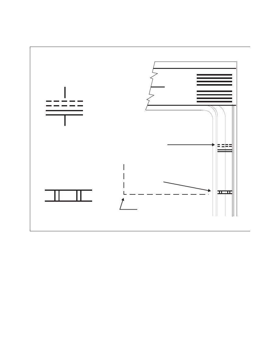
Holding Position Markings: ILS Critical Area
15
DETAIL 2
DETAIL 1
RUNWAY HOLDING
POSITION MARKINGS,
YELLOW, SEE
DETAIL 1
ILS HOLDING
POSITION MARKINGS,
YELLOW, SEE
DETAIL 2
ILS CRITICAL
AREA
2
−
3
−
6. Other Markings
a. Vehicle Roadway Markings.
The vehicle
roadway markings are used when necessary to define
a pathway for vehicle operations on or crossing areas
that are also intended for aircraft. These markings
consist of a white solid line to delineate each edge of
the roadway and a dashed line to separate lanes within
the edges of the roadway. In lieu of the solid lines,
zipper markings may be used to delineate the edges
of the vehicle roadway. (See FIG 2−3−18.) Details of
the zipper markings are shown in FIG 2−3−19.
b. VOR Receiver Checkpoint Markings.
The
VOR receiver checkpoint marking allows the pilot to
check aircraft instruments with navigational aid
signals. It consists of a painted circle with an arrow in
the middle; the arrow is aligned in the direction of the
checkpoint azimuth. This marking, and an associated
sign, is located on the airport apron or taxiway at a
point selected for easy access by aircraft but where
other airport traffic is not to be unduly obstructed.
(See FIG 2−3−20.)
NOTE
−
The associated sign contains the VOR station identification
letter and course selected (published) for the check, the
words “VOR check course,” and DME data (when
applicable). The color of the letters and numerals are black
on a yellow background.
EXAMPLE
−
DCA 176
−356
VOR check course
DME XXX