AIM
8/15/19
5
−
4
−
18
Arrival Procedures
f. Circling.
Circling minimums charted on an
RNAV (GPS) approach chart may be lower than the
LNAV/VNAV line of minima, but never lower than
the LNAV line of minima (straight-in approach).
Pilots may safely perform the circling maneuver at
the circling published line of minima if the approach
and circling maneuver is properly performed
according to aircraft category and operational
limitations.
FIG 5
−
4
−
12
Example of LNAV and Circling Minima Lower Than LNAV/VNAV DA.
Harrisburgh International RNAV (GPS) RWY 13
CATEGORY
A
B
C
D
LPV DA
558/24
250 (300
−
½
)
LNAV/
VNAV DA
1572
−
5
1264 (1300
−
5)
LNAV MDA
1180 / 24
872 (900
−
½
)
1180 / 40
872 (900
−
¾
)
1180 / 2
872 (900
−
2)
1180 / 2
¼
872 (900
−
2
¼
)
CIRCLING
1180
−
1
870 (900
−
1)
1180
−
1
¼
870 (900
−
1
¼
)
1180
−
2
½
870 (900
−
2
½
)
1180
−
2
¾
870 (900
−
2
¾
)
FIG 5
−
4
−
13
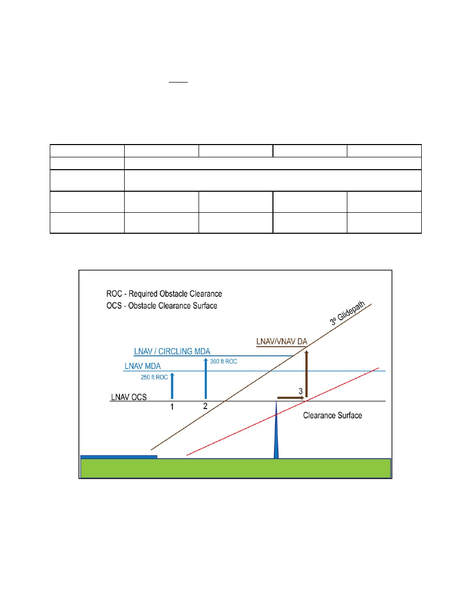
Explanation of LNAV and/or Circling Minima Lower than LNAV/VNAV DA
g.
FIG 5
−
4
−
13 provides a visual representation of
an obstacle evaluation and calculation of LNAV
MDA, Circling MDA, LNAV/VNAV DA.
1. No vertical guidance (LNAV).
A line is
drawn horizontal at obstacle height and 250 feet
added for Required Obstacle Clearance (ROC). The
controlling obstacle used to determine LNAV MDA
can be different than the controlling obstacle used in
determining ROC for circling MDA. Other factors
may force a number larger than 250 ft to be added to
the LNAV OCS. The number is rounded up to the next
higher 20 foot increment.