AIM
8/15/19
1
−
1
−
6
Navigation Aids
be flown while operating under random route IFR
conditions (14 CFR Section 91.177), even though
these altitudes may lie within the designated SSV.
Service volume restrictions are first published in
Notices to Airmen (NOTAMs) and then with the
alphabetical listing of the NAVAIDs in the Chart
Supplement U.S.
c.
Standard Service Volume limitations do not
apply to published IFR routes or procedures.
d.
VOR/DME/TACAN Standard Service Vol-
umes (SSV).
1.
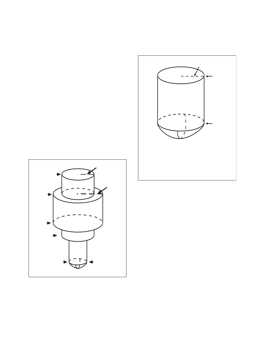
Standard service volumes (SSVs) are graphi-
cally shown in FIG 1
−
1
−
1, FIG 1
−
1
−
2, FIG 1
−
1
−
3,
FIG 1
−
1
−
4, and FIG 1
−
1
−
5. The SSV of a station is
indicated by using the class designator as a prefix to
the station type designation.
EXAMPLE
−
TVOR, LDME, and HVORTAC.
FIG 1
−
1
−
1
Standard High Altitude Service Volume
(See FIG 1
−
1
−
5 for altitudes below 1,000 feet).
60,000 ft.
100 NM
130 NM
45,000 ft.
18,000 ft.
14,500 ft.
1,000 ft.
40 NM
FIG 1
−
1
−
2
Standard Low Altitude Service Volume
(See FIG 1
−
1
−
5 for altitudes below 1,000 feet).
NOTE: All elevations shown are with respect
to the station’s site elevation (AGL).
Coverage is not available in a cone of
airspace directly above the facility.
40 NM
18,000 ft.
1,000 ft.
2.
Within 25 NM, the bottom of the T service
volume is defined by the curve in FIG 1
−
1
−
4. Within
40 NM, the bottoms of the L and H service volumes
are defined by the curve in FIG 1
−
1
−
5. (See
TBL 1
−
1
−
1.)
e.
Nondirectional Radio Beacon (NDB)
1.
NDBs are classified according to their
intended use.
2.
The ranges of NDB service volumes are
shown in TBL 1
−
1
−
2. The distances (radius) are the
same at all altitudes.