AIM
8/15/19
7
−
1
−
6
Meteorology
2. Observations & Warnings (Obs/Warn).
The Obs/Warn option provides an option to display
weather data for the current time and the previous
14 hours (rounded to the nearest hour). Users may
advance through time using the arrow buttons or by
clicking on the desired hour. Provided below are the
Obs/Warn product tabs available on the GFA website:
(a)
METAR
(b)
Precipitation/Weather (PCPN/WX)
(c)
Ceiling & Visibility (CIG/VIS)
(d)
Pilot Reports (PIREP)
(e)
Radar & Satellite (RAD/SAT)
3.
The GFA will be continuously updated and
available online at
http://new.aviationweather.gov/
areafcst
.
Upon clicking the link above, select INFO
on the top right corner of the map display. The next
screen presents the option of selecting Overview,
Products, and Tutorial. Simply select the tab of
interest to explore the enhanced digital and graphical
weather products designed to replace the legacy FA.
Users should also refer to AC 00
−
45,
Aviation
Weather Services,
for more detailed information on
the GFA.
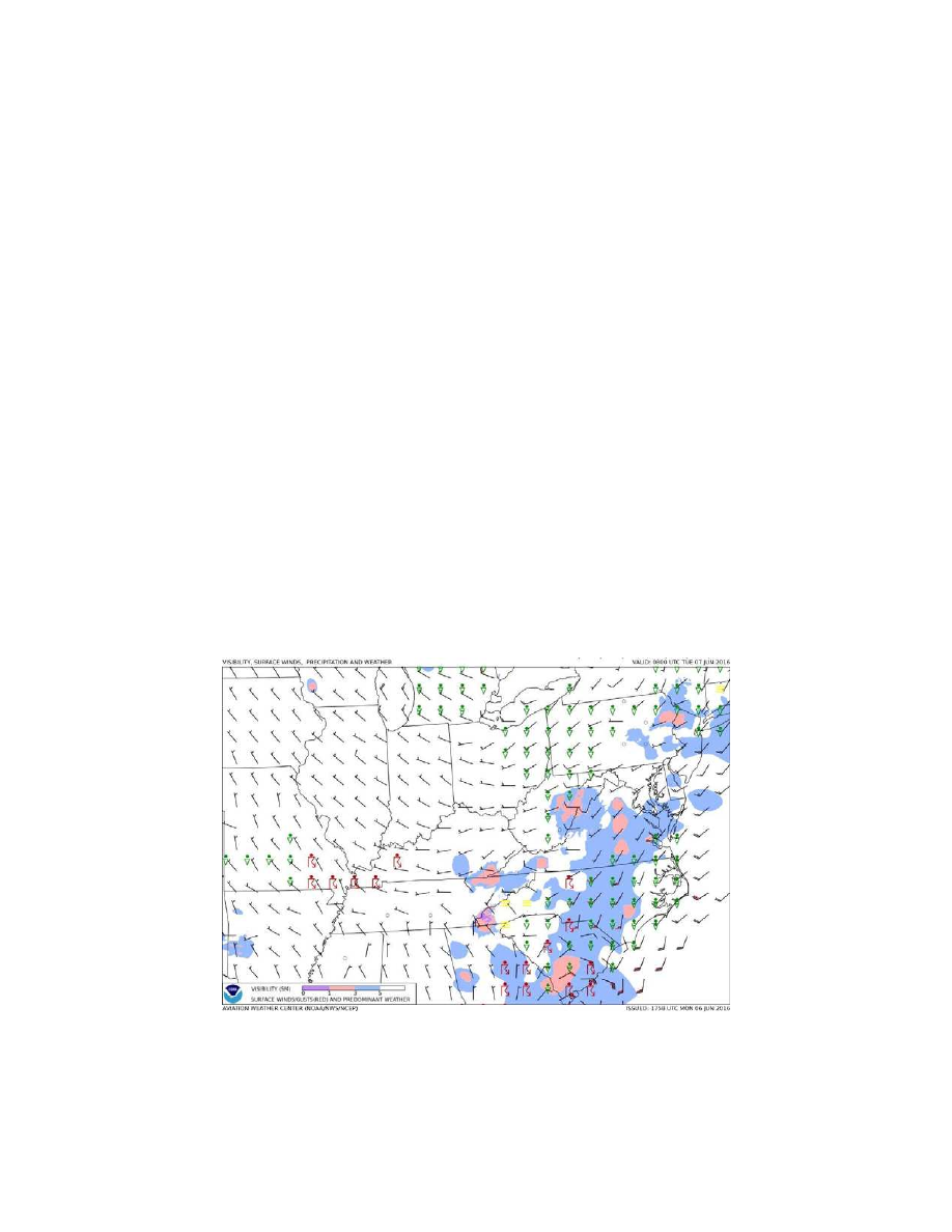
4. GFA Static Images.
Some users with
limited internet connectivity may access static
images via the Aviation Weather Center (AWC) at:
http://www.aviationweather.gov/gfa/plot
.
There
are two static graphical images available, titled
Aviation Cloud Forecast
and
Aviation Surface
Forecast
. The Aviation Cloud Forecast provides
cloud coverage, bases, layers, and tops with Airmet
Sierra for mountain obscuration and Airmet Zulu for
icing overlaid. The Aviation Surface Forecast
provides visibility, weather phenomena, and winds
(including wind gusts) with Airmet Sierra for
instrument flight rules conditions and Airmet Tango
for sustained surface winds of 30 knots or more
overlaid. These images are presented on ten separate
maps providing forecast views for the entire CONUS
on one and nine regional views which provide more
detail for the user. They are updated every 3 hours and
provide forecast snapshots for 3, 6, 9, 12, 15, and
18 hours into the future. (See FIG 7
−
1
−
2 and
FIG 7
−
1
−
3.)
FIG 7
−
1
−
2
Aviation Surface Forecast