AIM
8/15/19
9
−
1
−
11
Types of Charts Available
The DACS individual data files are:
ENHIGH.DAT: High altitude airways (contermi-
nous U.S.)
ENLOW.DAT: Low altitude airways (conterminous
U.S.)
IAPFIX.DAT: Selected instrument approach proce-
dure NAVAID and fix data.
MTRFIX.DAT: Military training routes data.
ALHIGH.DAT: Alaska high altitude airways data.
ALLOW.DAT: Alaska low altitude airways data.
PR.DAT: Puerto Rico airways data.
HAWAII.DAT: Hawaii airways data.
BAHAMA.DAT: Bahamas routes data.
OCEANIC.DAT: Oceanic routes data.
STARS.DAT: Standard terminal arrivals data.
DP.DAT: Instrument departure procedures data.
LOPREF.DAT: Preferred low altitude IFR routes
data.
HIPREF.DAT: Preferred high altitude IFR routes
data.
ARF.DAT: Air route radar facilities data.
ASR.DAT: Airport surveillance radar facilities data.
2. The Coded Instrument Flight Procedures
(CIFP) (ARINC 424 [Ver 13 & 15]).
The CIFP is a
basic digital dataset, modeled to an international
standard, which can be used as a basis to support GPS
navigation. Initial data elements included are: Airport
and Helicopter Records, VHF and NDB Navigation
aids, en route waypoints and airways. Additional data
elements will be added in subsequent releases to
include: departure procedures, standard terminal
arrivals, and GPS/RNAV instrument approach
procedures. The database is updated every 28 days.
The data is available by subscription only and is
distributed on CD
−
ROM or by ftp download.
3. digital
−
Visual Charts (d
−
VC).
These digi-
tal VFR charts are geo
−
referenced images of FAA
Sectional Aeronautical, TAC, and Helicopter Route
charts. Additional digital data may easily be overlaid
on the raster image using commonly available
Geographic Information System software. Data such
as weather, temporary flight restrictions, obstacles, or
other geospatial data can be combined with d
−
VC
data to support a variety of needs. The file resolution
is 300 dots per inch and the data is 8
−
bit color. The
data is provided as a GeoTIFF and distributed on
DVD
−
R media and on the AIS website. The root
mean square error of the transformation will not
exceed two pixels. Digital
−
VC DVDs are updated
every 28 days and are available by subscription only.
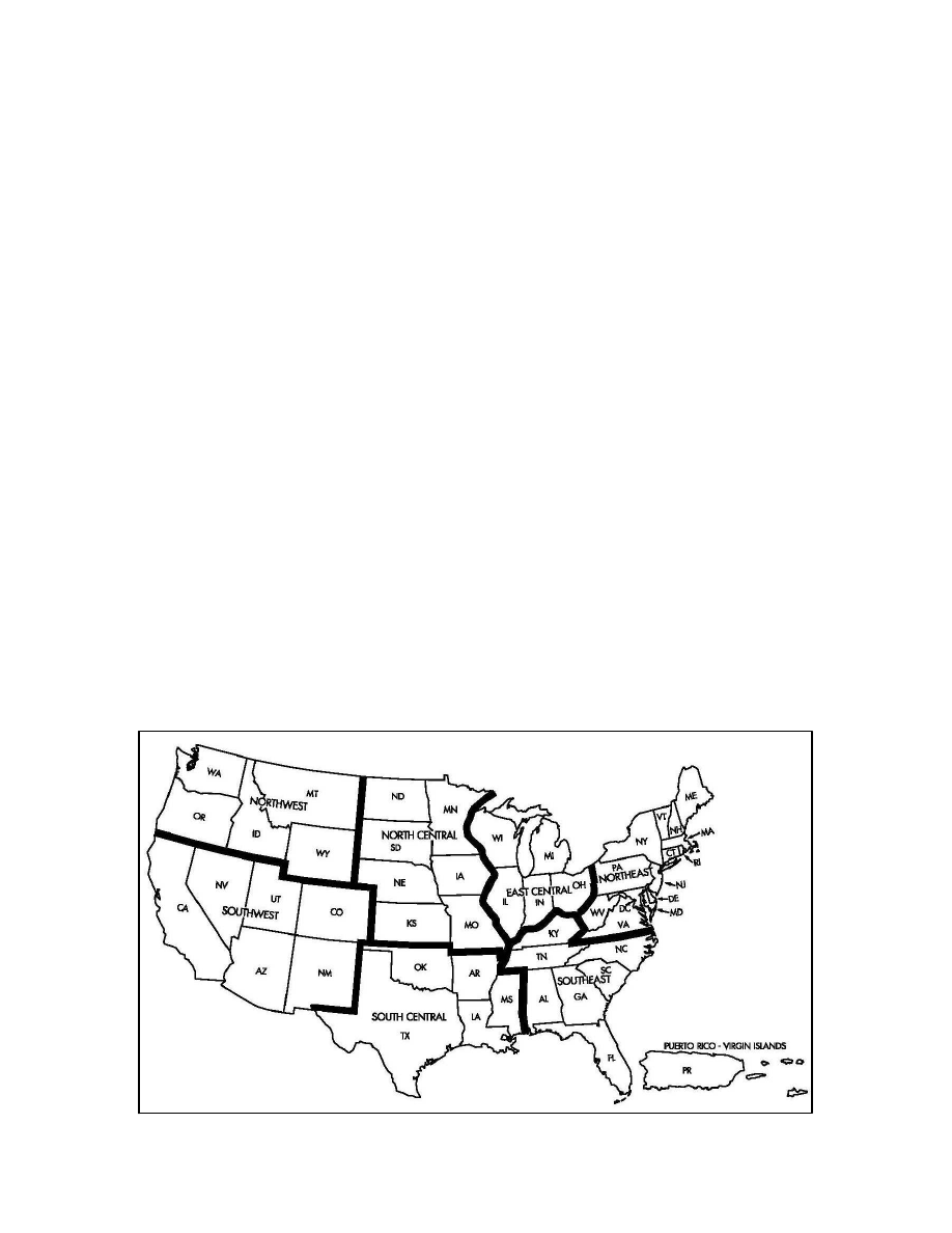
FIG 9
−
1
−
14
Chart Supplement U.S. Geographic Areas