AIM
4/3/14
1−1−15
Navigation Aids
FIG 1
−1−8
Coverage Volume
Azimuth
APPROACH
AZIMUTH
AZIMUTH
-40°
+40°
20 NM
ESV
ESV
14 NM
+60°
MAXIMUM LIMIT
14 NM
-60°
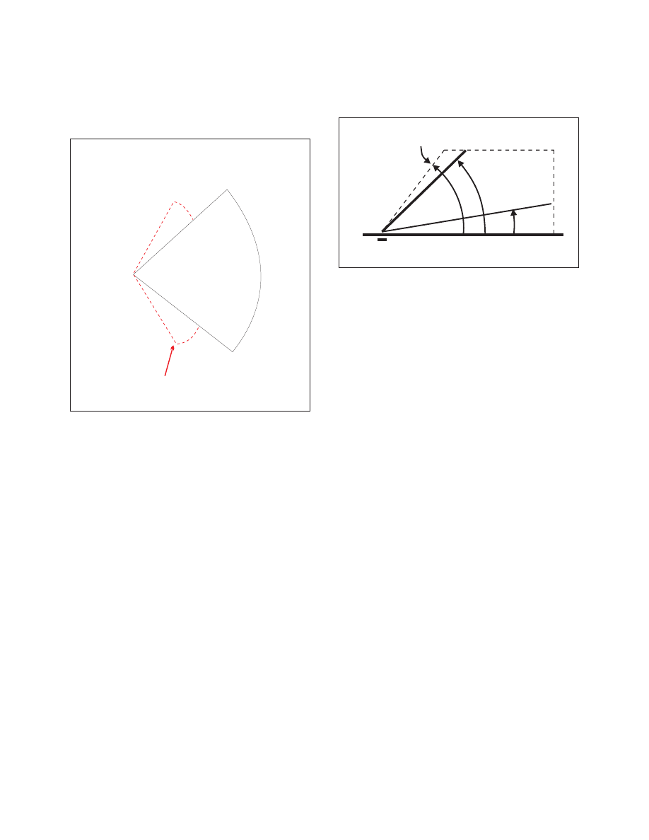
c. Elevation Guidance
1.
The elevation station transmits signals on the
same frequency as the azimuth station. A single
frequency is time−shared between angle and data
functions.
2.
The elevation transmitter is normally located
about 400 feet from the side of the runway between
runway threshold and the touchdown zone.
3.
Elevation coverage is provided in the same
airspace as the azimuth guidance signals:
(a)
In elevation, to at least +15 degrees;
(b)
Laterally, to fill the Azimuth lateral
coverage; and
(c)
In range, to at least 20 NM.
(See FIG 1−1−9.)
FIG 1
−1−9
Coverage Volumes
Elevation
ELEVATION
ELEVATION
NORMAL
GLIDE PATH
NORMA
L
GLIDE
PATH
MAXIMUM LIMIT
MAXIMUM LIMIT
20,000’
20 NM
20 NM
30
3
15
o
o
o
o
d. Range Guidance
1.
The MLS Precision Distance Measuring
Equipment (DME/P) functions the same as the
navigation DME described in paragraph 1−1−7,
Distance Measuring Equipment (DME), but there are
some technical differences. The beacon transponder
operates in the frequency band 962 to 1105 MHz and
responds to an aircraft interrogator. The MLS DME/P
accuracy is improved to be consistent with the
accuracy provided by the MLS azimuth and elevation
stations.
2.
A DME/P channel is paired with the azimuth
and elevation channel. A complete listing of the
200 paired channels of the DME/P with the angle
functions is contained in FAA Standard 022 (MLS
Interoperability and Performance Requirements).
3.
The DME/N or DME/P is an integral part of
the MLS and is installed at all MLS facilities unless
a waiver is obtained. This occurs infrequently and
only at outlying, low density airports where marker
beacons or compass locators are already in place.
e. Data Communications
1.
The data transmission can include both the
basic and auxiliary data words. All MLS facilities
transmit basic data. Where needed, auxiliary data can
be transmitted.
2. Coverage limits.
MLS data are transmitted
throughout the azimuth (and back azimuth when
provided) coverage sectors.
3. Basic data content.
Representative data
include:
(a)
Station identification;