AIM
4/3/14
10−2−12
Special Operations
e. Helping the Flightcrew Locate the Scene
1.
If the LZ coordinator has access to a GPS unit,
the exact latitude and longitude of the LZ should be
relayed to the HEMS pilot. If unable to contact the
pilot directly, relay the information to the HEMS
ground communications specialist for relaying to the
pilot, so that they may locate your scene more
efficiently. Recognize that the aircraft may approach
from a direction different than the direct path from the
takeoff point to the scene, as the pilot may have to
detour around terrain, obstructions or weather
en route.
2.
Especially in daylight hours, mountainous
and densely populated areas can make sighting a
scene from the air difficult. Often, the LZ coordinator
on the ground will be asked if she or he can see or hear
the helicopter.
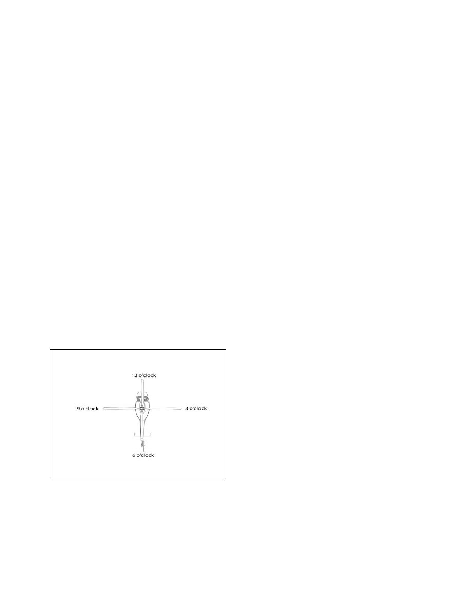
3.
Flightcrews use a clock reference method for
directing one another’s attention to a certain direction
from the aircraft. The nose of the aircraft is always
12 o’clock, the right side is 3 o’clock, etc. When the
LZ coordinator sees the aircraft, he/she should use
this method to assist the flightcrew by indicating the
scene’s clock reference position from the nose of the
aircraft. For example, “Accident scene is located at
your 2 o’clock position.” See FIG 10−2−6.
FIG 10
−2−6
“Clock” System for Identifying Positions
Relative to the Nose of the Aircraft
4.
When the helicopter approaches the scene, it
will normally orbit at least one time as the flight crew
observes the wind direction and obstacles that could
interfere with the landing. This is often referred to as
the “high reconnaissance” maneuver.
f. Wind Direction and Touchdown Area
1.
Determine from which direction the wind is
blowing. Helicopters normally land and takeoff into
the wind.
2.
If contact can be established with the pilot,
either directly or indirectly through the HEMS
ground communications specialist, describe the wind
in terms of the direction the wind is from and the
speed.
3.
Common natural sources of wind direction
information are smoke, dust, vegetation movement,
water streaks and waves. Flags, pennants, streamers
can also be used. When describing the direction, use
the compass direction from which the wind is
blowing (example: from the North−West).
4.
Wind speed can be measured by small
hand−held measurement devices, or an observer’s
estimate can be used to provide velocity information.
The wind value should be reported in knots (nautical
miles per hour). If unable to numerically measure
wind speed, use TBL 10−2−3 to estimate velocity.
Also, report if the wind conditions are gusty, or if the
wind direction or velocity is variable or has changed
recently.
5.
If any obstacle(s) exist, ensure their descrip-
tion, position and approximate height are
communicated to the pilot on the initial radio call.