Index
561
-- Page 562 --
563
7110.65R
AIM
AIM      CHG 2                                                                                            3/15/07
                                                                                                         11/10/16
                                                                                                         12/10/15


      2. IFR En Route High Altitude Charts                  frequency, identification, channel, geographic coor-
(Conterminous U.S. and Alaska). En route high               dinates; selected airports; reporting points. Scales
altitude charts are designed for navigation at or above     vary from 1 inch = 45nm to 1 inch = 18nm. 55 x 20
18,000 feet MSL. This four-color chart series               inches folded to 5 x 10 inches. Revised every 56 days.
includes the jet route structure; VHF NAVAIDs with          (See FIG 9-1-7 and FIG 9-1-8.)


                                                     FIG 9-1-7
                            En Route High Altitude Charts for the Conterminous U.S.


                                                     FIG 9-1-8
                                     Alaskan En Route High Altitude Chart


9-1-6                                                                                   Types of Charts Available
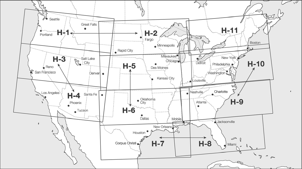 FIG 9-1-7
En Route High Altitude Charts for the Conterminous U.S.
FIG 9-1-7
En Route High Altitude Charts for the Conterminous U.S.
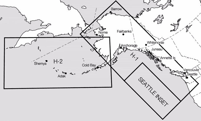 FIG 9-1-8
Alaskan En Route High Altitude Chart
9-1-6 Types of Charts Available
FIG 9-1-8
Alaskan En Route High Altitude Chart
9-1-6 Types of Charts Available