AIM
4/3/14
1−1−6
Navigation Aids
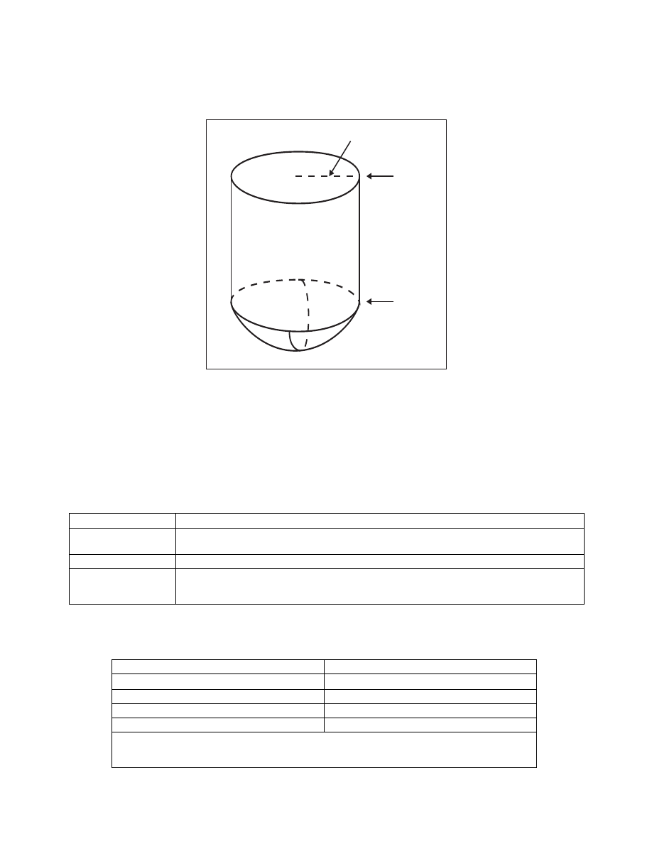
FIG 1
−1−3
Standard Terminal Service Volume
(See FIG 1−1−4 for altitudes below 1,000 feet).
25 NM
12,000 ft.
1,000 ft.
2.
Within 25 NM, the bottom of the T service
volume is defined by the curve in FIG 1−1−4. Within
40 NM, the bottoms of the L and H service volumes
are defined by the curve in FIG 1−1−5. (See
e.
Nondirectional Radio Beacon (NDB)
1.
NDBs are classified according to their
intended use.
2.
The ranges of NDB service volumes are
shown in TBL 1−1−2. The distances (radius) are the
same at all altitudes.
TBL 1
−1−1
VOR/DME/TACAN Standard Service Volumes
SSV Class Designator
Altitude and Range Boundaries
T (Terminal) . . . . . . . .
From 1,000 feet above ground level (AGL) up to and including 12,000 feet AGL at radial distances out
to 25 NM.
L (Low Altitude) . . . .
From 1,000 feet AGL up to and including 18,000 feet AGL at radial distances out to 40 NM.
H (High Altitude) . . . .
From 1,000 feet AGL up to and including 14,500 feet AGL at radial distances out to 40 NM. From
14,500 AGL up to and including 60,000 feet at radial distances out to 100 NM. From 18,000 feet AGL
up to and including 45,000 feet AGL at radial distances out to 130 NM.
TBL 1
−1−2
NDB Service Volumes
Class
Distance (Radius)
Compass Locator
15 NM
MH
25 NM
H
50 NM*
HH
75 NM
*Service ranges of individual facilities may be less than 50 nautical miles (NM). Restrictions to service
volumes are first published as a Notice to Airmen and then with the alphabetical listing of the NAVAID in
the A/FD.